

GeoWeb: Enterprise Web Mapping Platform for Spatial Intelligence
Developed by AkoMind
GeoWeb enables organizations to build advanced geoportals, monitoring systems, and mission-critical spatial applications with seamless integration, real-time visualization, and enterprise-grade extensibility.
Key Capabilities at a Glance
Interactive 2D and 3D Web Mapping
Real-time Monitoring & Operational Dashboards
Modular Plugin Architecture
Seamless Integration with Enterprise Systems
Advanced Spatial Analysis & Visualization Tools
Secure, Scalable & Enterprise-ready Platform
What Is GeoWeb?
GeoWeb is an enterprise web mapping platform designed to power modern geospatial applications directly in the browser.
Built on a modular and scalable architecture, GeoWeb provides a highly flexible front-end environment for spatial visualization, monitoring, and analysis. It enables organizations to develop geoportals, operational dashboards, and spatial intelligence systems tailored to their specific needs.
GeoWeb integrates seamlessly with GeoServer, supports OGC standards, and connects easily with enterprise infrastructure, making it ideal for mission-critical operational environments.
How GeoWeb Works?
Connect
Process
Visualize
Analyze and Act
GeoWeb Core Features

Advanced Interactive Web Mapping
Provides comprehensive map interaction tools including zoom, identify, measure, query, and layer control.
Ensures smooth, dynamic, and high-performance map visualization in web environments.

Modular Plugin-Based Architecture
Built on a powerful and extensible plugin framework.
Allows rapid development of custom tools and seamless integration with enterprise systems.

Dashboard & Analytical Widgets
Enables creation of spatial dashboards combining maps, charts, KPIs, and data widgets.
Supports real-time and analytical geospatial intelligence workflows.

OGC-Compliant Services Support
Supports WMS, WFS, WMTS, and other OGC services.
Ensures interoperability with GIS servers and spatial infrastructures.
Advanced Layer Management
Full control over layer ordering, grouping, visibility, opacity, scale ranges, and filtering.
Supports dynamic configuration and multi-source data integration.

Attribute Table & Spatial Query Engine
Interactive attribute tables synchronized with map layers.
Supports advanced attribute filtering and spatial query operations.

Spatial Editing & Data Update
Provides tools for drawing, editing, and modifying vector geometries directly on the map.
Supports integration with backend services for transactional data updates.

Style Management & SLD Editor
Integrated style management through GeoServer.
Supports dynamic styling, thematic mapping, and rule-based rendering.

Print & Export Engine
Generate high-quality printable map layouts.
Supports configurable templates and multiple export formats.

3D Visualization & Terrain Support
Supports 3D map rendering and terrain visualization.
Enables integration of 3D spatial data and real-time object tracking.

Security, SSO & Token-Based Authentication
Supports token-based authentication, enterprise SSO integration, and role-based access control.
Ensures secure and controlled access to spatial resources.

API & Webhook Integration
Supports API-based data ingestion and outbound webhook triggers.
Enables integration with external monitoring and enterprise systems.
Geo-Fencing & Event-Based Workflows
Define spatial rules and event-driven triggers.
Supports automated workflows based on spatial or attribute changes.
Customizable Layout & Enterprise Branding
Fully customizable UI layout and theming.
Allows complete alignment with corporate branding guidelines.
Custom Plugin Capabilities
Weather & METAR Visualization
Real-time visualization of aviation weather (METAR), visibility range, and atmospheric conditions.
Supports spatial representation of weather stations and operational status.
Elevation Profile Tool
Generates elevation profiles along user-defined paths.
Useful for terrain analysis, infrastructure planning, and operational assessment.
Line-of-Sight (LOS) Analysis
Calculates visibility between observer and target points.
Supports surveillance planning and terrain-based visibility assessment.
Hydrology Analysis Tools
Provides hydrological visualization and water flow analysis.
Supports watershed monitoring and environmental planning.
Urban & Road Routing Engine
Supports urban and intercity routing with shortest-path calculation.
Enables logistics planning and mobility analysis.
Religious Prayer Time Module
Displays prayer times based on geographic location.
Supports region-specific time calculations and spatial adjustments.
Buffer & Proximity Analysis
Create buffer zones around points, lines, or polygons.
Supports impact assessment and spatial proximity analysis.
Urban Data Visualization via Overpass
Dynamic retrieval and visualization of urban layers using Overpass API.
Enables real-time integration of OpenStreetMap-based city features.
Surveillance & Monitoring Environment Definition
Define custom monitoring zones and observation environments.
Supports layered security mapping and operational area management.
3D Target Tracking
Real-time tracking of moving targets in 3D space.
Supports operational monitoring, simulation, and spatial intelligence systems.
Who Can Benefit from GeoWeb
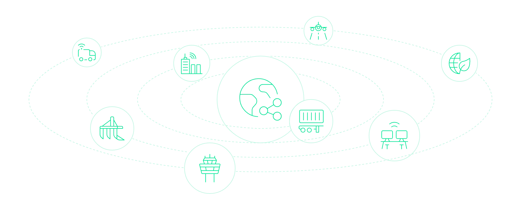
GeoWeb is ideal for a wide range of industries and operational environments:
- Fleet tracking and transportation monitoring
- Smart city platforms
- Defense and surveillance systems
- Environmental monitoring
- Infrastructure and utility management
- Aviation and airport systems
- Logistics and mobility platforms
- Operational command and control centers
A Unified Ecosystem for Your Business Needs
GeoWeb is fully integrated into the AkoMind business suite, serving as the spatial visualization and interaction layer across connected operational systems. It works seamlessly with other AkoMind platforms, enabling unified monitoring, tracking, and spatial intelligence within a single ecosystem.
At the same time, GeoWeb is designed for interoperability with external GIS and enterprise solutions. It integrates easily with GeoServer, spatial databases, enterprise APIs, and third-party systems using standard OGC services and modern web protocols. This allows organizations to extend their existing infrastructure while maintaining a centralized, scalable, and future-ready geospatial platform.


Ready to Power Your Spatial Platform
Whether you are developing a geoportal, monitoring platform, or spatial intelligence solution, GeoWeb delivers the flexibility, performance, and enterprise capabilities required.